


Wild Coast Publishing
211 Barkley Sound Kayaking and Boating Map
211 Barkley Sound Kayaking and Boating Map
Couldn't load pickup availability
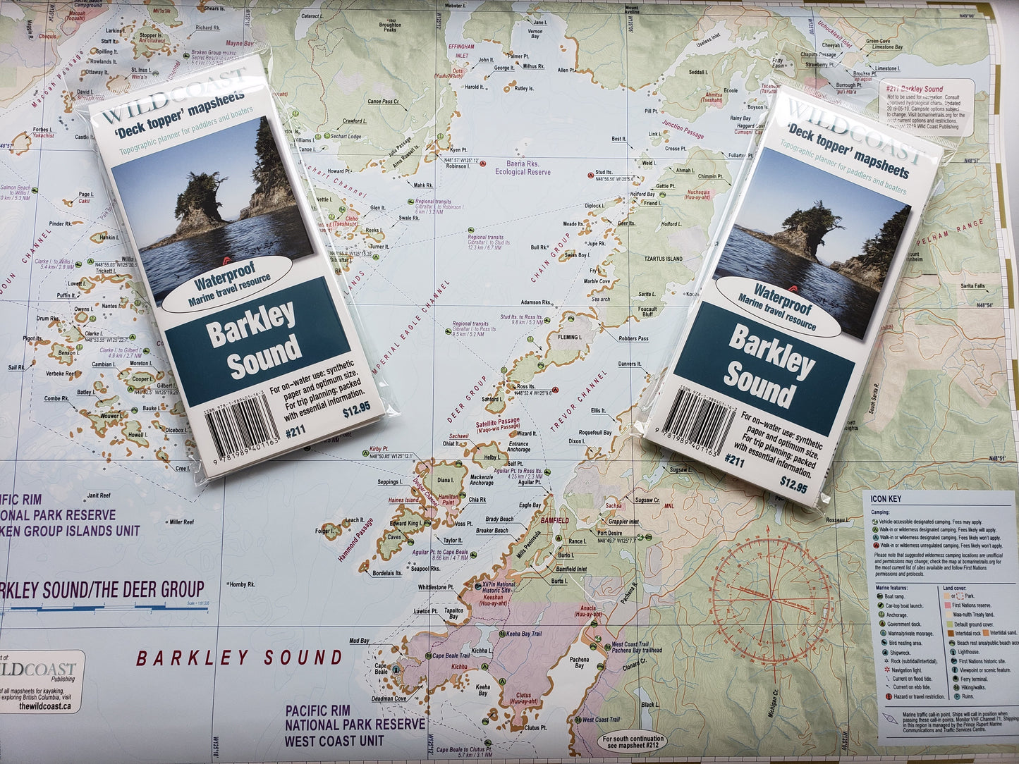
Updated for 2025. All 2025 editions purchased through online orders will be shipped with a clip to maintain the folds rather than a plastic wrapper to reduce plastic consumption. Note that mapsheet #211 contains numerous and significant updates to camping options in the Deer Group for 2025, among other changes.
Features:
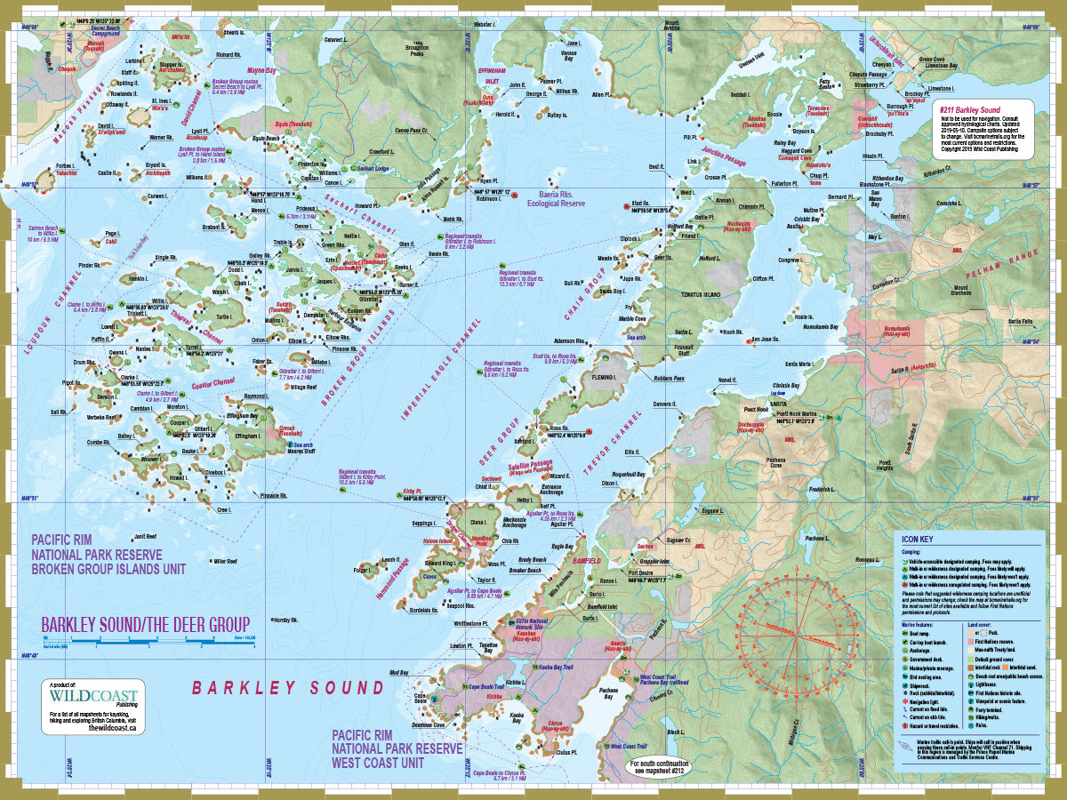
- Includes full coverage of the Deer Group and the Broken Group Islands unit of Pacific Rim National Park Reserve, as well as adjacent waterways including Bamfield Inlet and the outer coast to Pachena Bay.
- The mapsheet contains all land and marine features of interest, including campsites, anchorages, launch points, rest stop, attractions and hazards.
- In combination with mapsheet #210, The Broken Group, your exploration can be expanded to cover all of Barkley Sound. Handy overlap between the two regions means never having to navigate in the border between the two maps. Note that this map may be sufficient for explorations of both areas without requiring mapsheet #210, unless explorations include areas near Ucluelet. Mapsheet #210 also includes an expanded view of the Broken Group Islands to assist navigation and travel planning.
- UTM grid lines for easy distance calculations. Learn to understand and make the most of them.
- Our in-house printing allows frequent product updates to ensure the latest information.
- Printed on extremely waterproof/durable 10-mil stock when 4.3-mil stock is the norm.
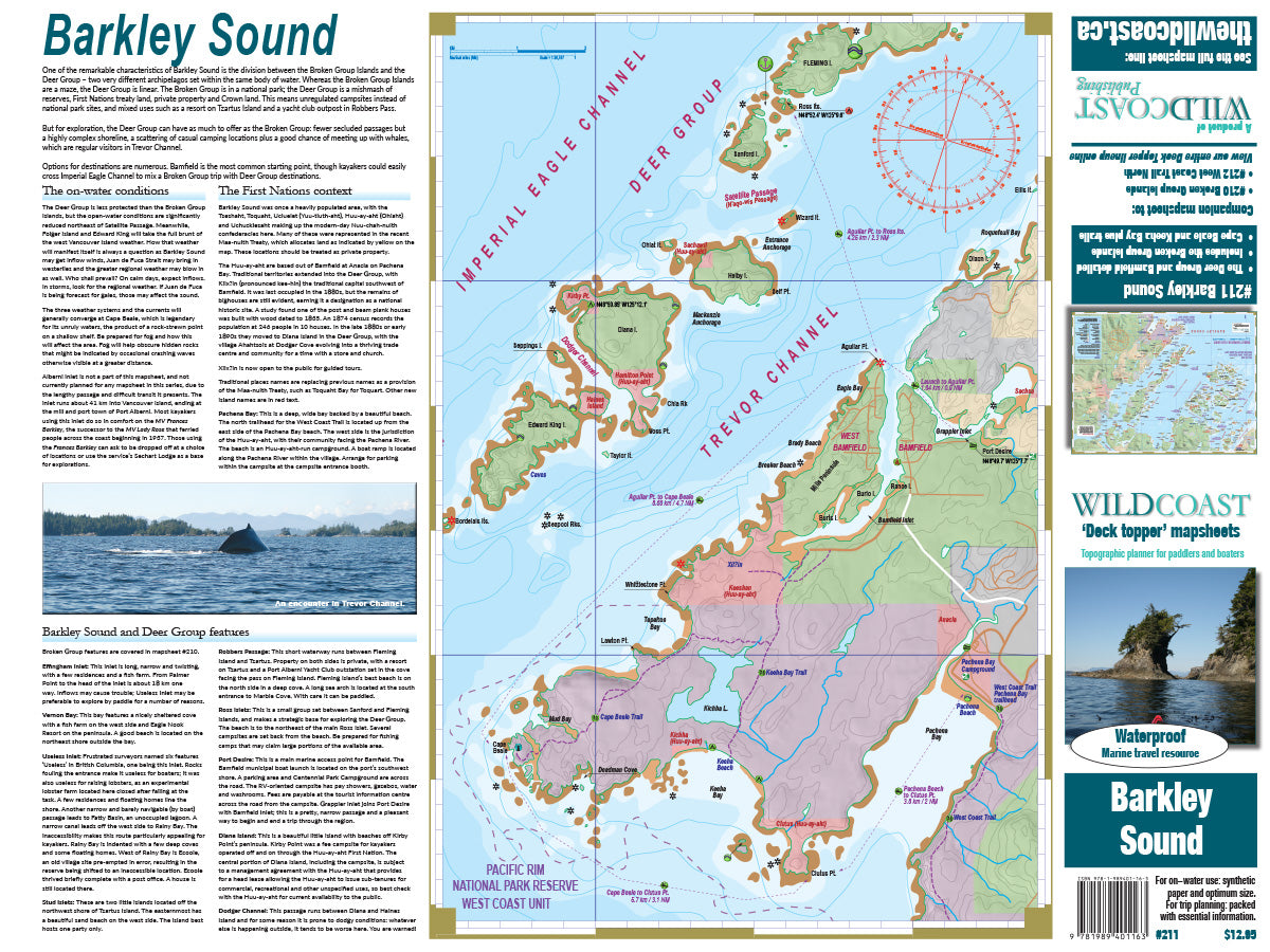
- Planning and logistical information is included on the opposite side of the main map to help make your adventure come to life.
- Optimal size and format for use both at home for planning and on-water during your travels.
- Augment your GPS navigation with a handy visual overview as you travel and as you plan your next day's agenda. In combination you will be well prepared for your adventure.
- Use alone without electronic assistance by navigating the traditional way without reliance on batteries or connectivity. Truly disconnect!
Don't forget the guide book: The perfect companion to this mapsheet is the BC Coast Explorer Vol. 1, which goes into much greater details about the features, attractions travel logistics and history.
New! All 200-series mapsheets now include UTM grid lines. Learn to understand and make the most of them.
About the Wild Coast map series: In 2019, Wild Coast Publishing began embarking on an ambitious program to provide an unbroken series of mapsheets covering the entire BC coastline. The series begins with mapsheet #201 Brooks Peninsula and extends in order down the outer Vancouver Island and up the southern BC coast then finally north through the Inside Passage. You can view the currently available list of mapsheets here. The maps are designed for paddlers and boaters, right down to the size -- a handy 24x18", slightly smaller than a traditional street map and so easy to manage when on the water. Use it as a "deck topper" for easy visualization as you travel on the water, use it around the campfire or your anchorage at night to plan your next day's route, and at home for research when your journey is still in the dream stage.
Get the Expedition pack: If you are transiting the coast or interested in more of the West Coast Vancouver Island titles, the West Vancouver Island Expedition Pack is your value option. Get all mapsheets #201 to #211 from Side Bay and Brooks Peninsula to Bamfield and Barkley Sound in one set. This saves significantly over the individual purchase price of the 11 mapsheets.
Shipping information: Please read the information in the link before ordering, as doing so will help determine if you will receive your order in time for your trip. See shipping alerts and shipping policy details here.
Share
Get free shipping! Order two to three items with this order instead of just this one and we'll ship them to you at no cost!